North Slave fire complex
November 29, 2023
Kaileen McCulloch
Software Developer

There were many major fire events this summer and one that got a lot of press was the evacuation of Yellowknife, the capital city of the Northwest Territories. Approximately 20,000 residents were ordered to evacuated, making this one of the biggest wildfire related evacuations in Canadian history. Other notably large evacuations were Fort McMurray in 2016 with approximately 88,000 people having been evacuated and Okanagan Mountain Park fire in 2003 when approximately 33,000 people were evacuated.
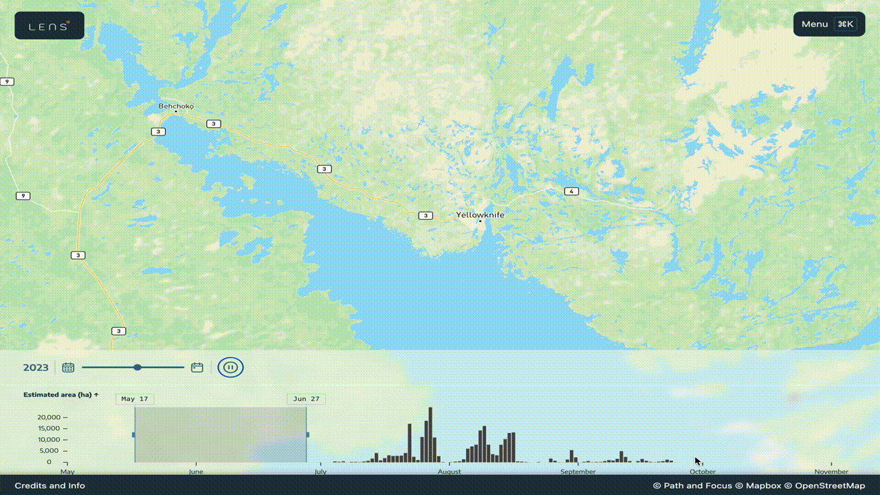
This video is an aerial view of the wildfire behaviour leading up to the evacuation order of Yellowknife. These are hotspots, heat signatures, on the earths surface captured by satellites. You can see that the biggest fire spread occurred between July 25 and July 27. An interesting observation is that there is a down period after this where we see little fire behaviour. It's not until August 4 that we see fire behaviour pick up again. This time with a fourth fire start South of Yellowknife. At the same time there is a re-activation of the Northern fire with a branch taking a run towards the city. On August 13 and August 14 you can observe significant fire behaviour that expands that spur significantly towards Yellowknife. The next day the government of Yellowknife declares a state of emergency and the following day issues the evacuation order.
** Disclaimer: we have multiple sources from which we can assess fire size one is to use the approximate burned area perimeters generated from satellite detected hotspots (this is the first of the range given) and the other is from the active wildfire data published by CWFIS which is updated daily by fire management agencies (the second of the range given). **